 FARNESS
FARNESS
FARNESS
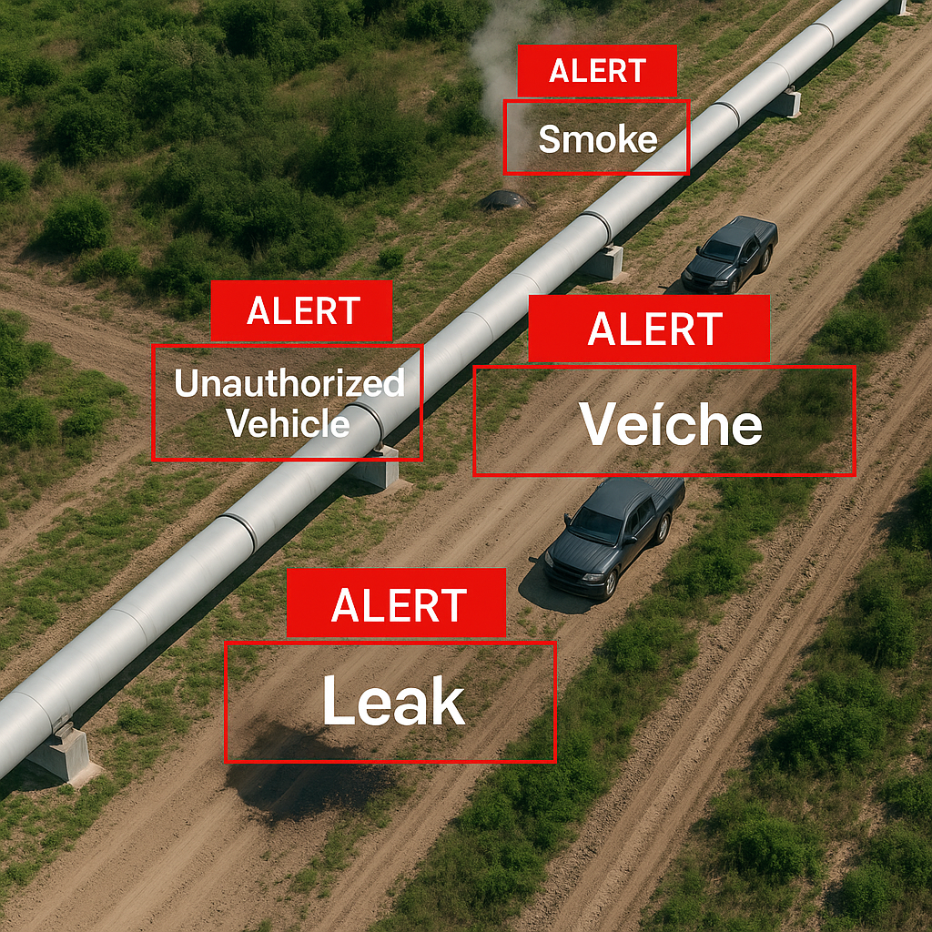
Automated detection of leaks, damage, theft, and anomalies along pipelines. Drones regularly patrol and report any irregularities.
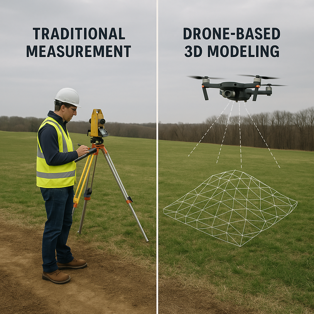
Our drones fly over stockpiles to create ultra-precise 3D models and instantly deliver volume estimates.
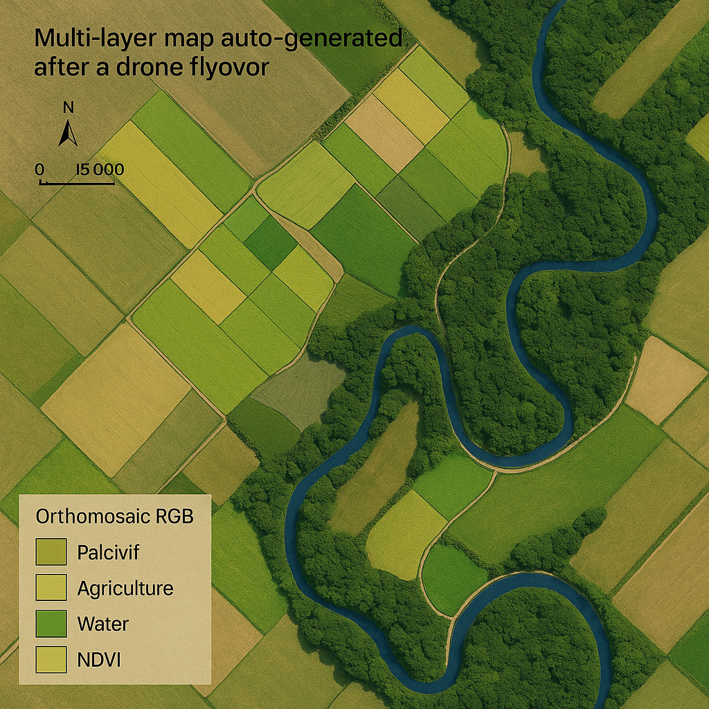
High-resolution mapping of unexplored territories, showing terrain features (relief, vegetation, moisture).
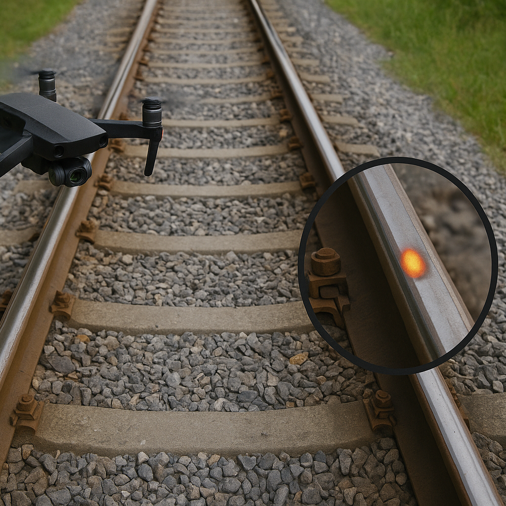
Continuous rail inspection to detect cracks, obstacles, or structural anomalies. Prevents accidents and reduces service interruptions.
Secure vast mining sites with drones that detect intrusions or anomalies in real time.
Inspect pipelines, conveyors, power lines, and rail systems with zero downtime using drones.
Get ultra-precise volume estimates instantly to manage logistics and boost sales efficiency.
Map and explore terrain for geological or strategic development with drone-based automation.
Visualize cost reduction and efficiency improvements in mining operations using drone automation.
Layered maps of mining zones for strategic planning, terrain analysis, and exploration initiatives.
In a mining context, drone-based automation reduces human risk in hazardous areas, minimizes delays, and provides real-time insights. This leads to improved site safety, better planning, and operational cost reductions.